I Love Maps!
I really do love maps!
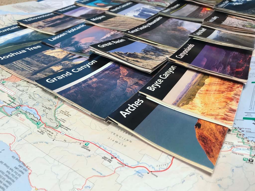
I like to use maps when I am on an extended hiking/backpacking trip; there is a desire to know the names of mountains and lakes, to visually see what is beyond the closest mountain range, and to make sure I am heading in the right direction. (In particular I really enjoy Green Trail Maps or FarOut in printed and digital formats.) I also like to collect maps. My collection serves as a memory for past trips and are a great tool for envisioning a return to that place.
I am intrigued by maps as art. I have a few hanging in my house and most of them have a different take on a traditional map.
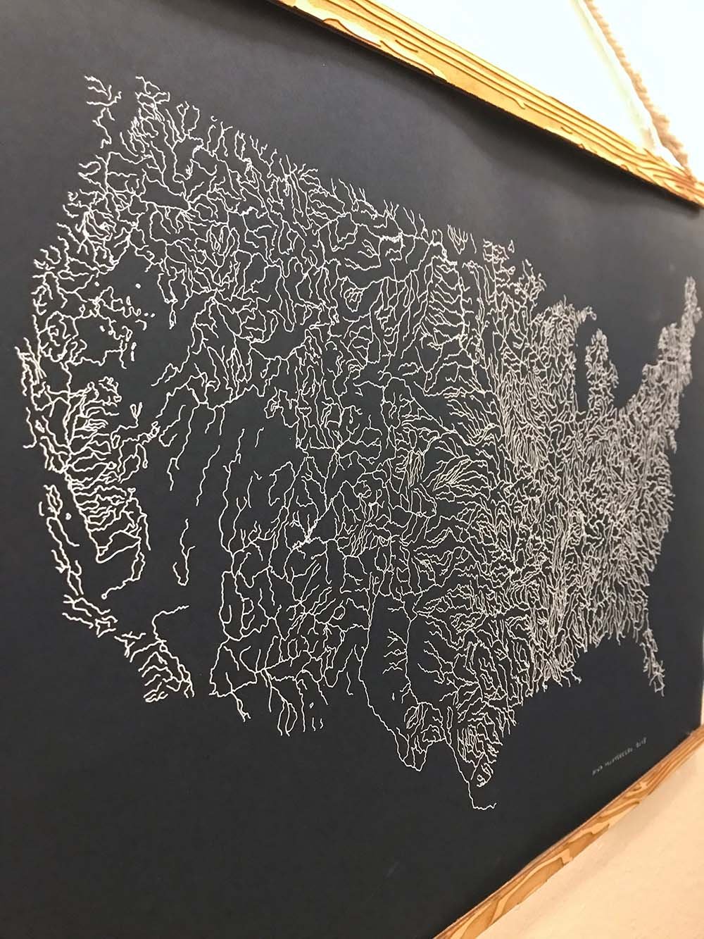
Take the map of the Rivers of America by The Far Woods. It is artistic and visually rich. You can’t pinpoint direct rivers but you can decipher where it is arid and wet.
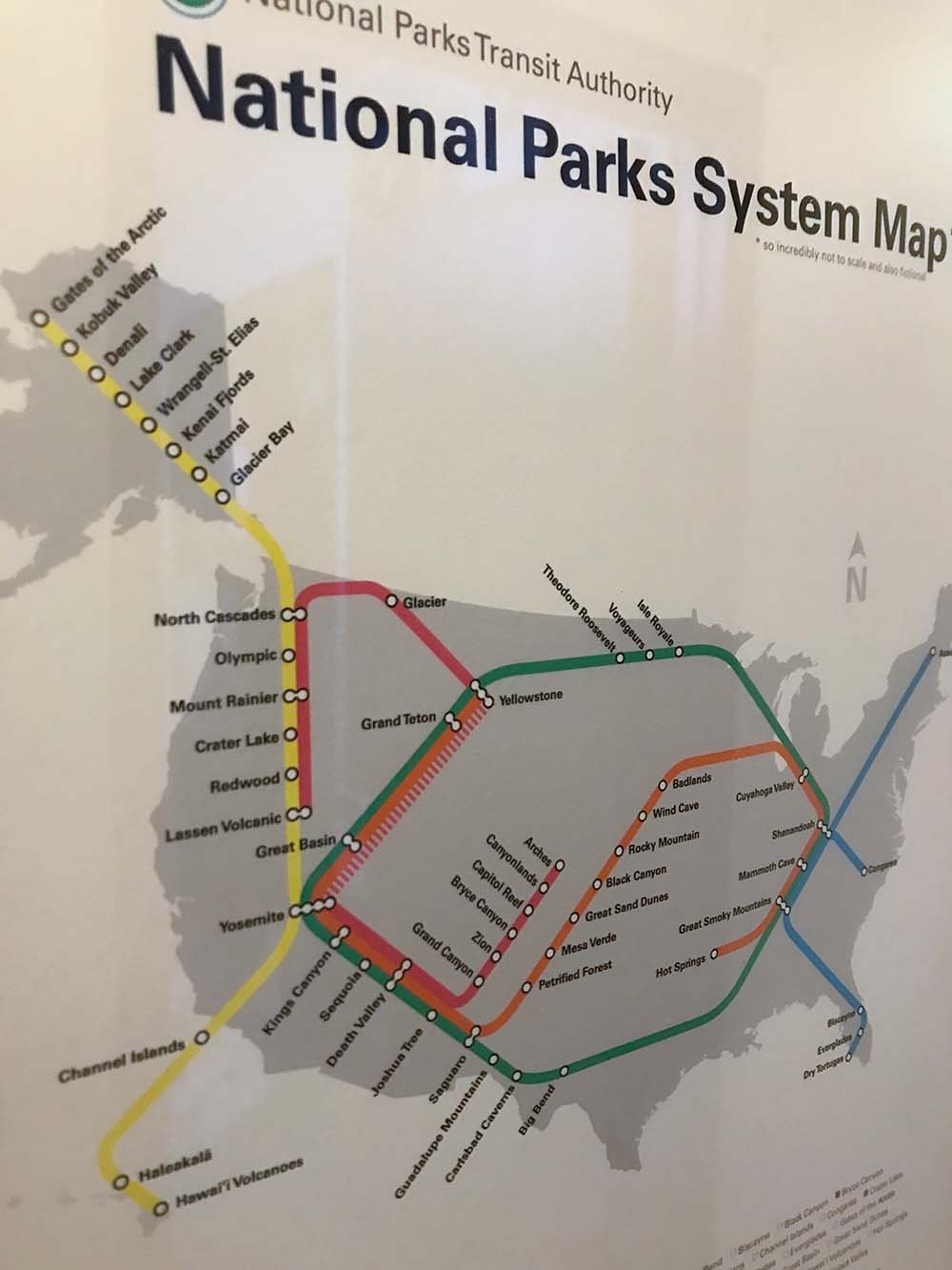
One year for an April Fool’s joke the Sierra Club put out a fictitious map that uses the visual language of a subway map with the content of National Parks. It is super playful but also gives a sense of how you could combine many parks into one epic road trip.
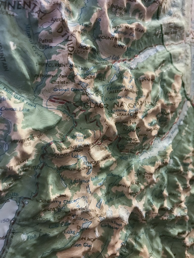
I worked two summers in Glacier National Park and it is one of my favorite places. The 3D map by Hubbard Scientific Inc, reminds me to my time spent walking among glacial lakes, seeing my first ptarmigan, and drinking one to many mint chocolate milkshakes.
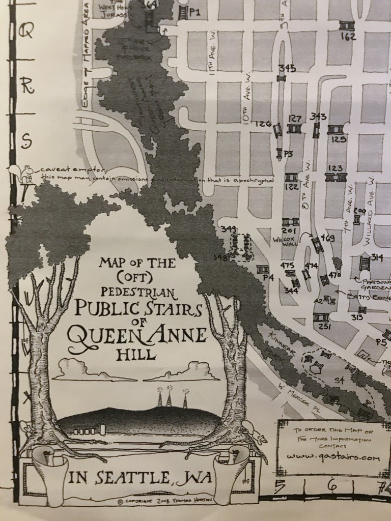
The first neighborhood I lived in Seattle was Queen Anne. It’s a hill and there is a ton of staircases. The Pedestrian Public Stairs of Queen Anne Hill by Thomas Horton leaves out one staircase. This gives the viewer the chance to put this map into action and explore.
My Illustrated Hiking Maps
I love the outdoors! I love maps! It made sense to create illustrated maps.
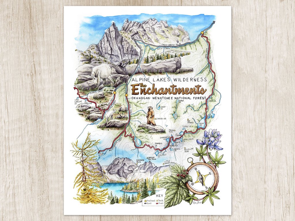
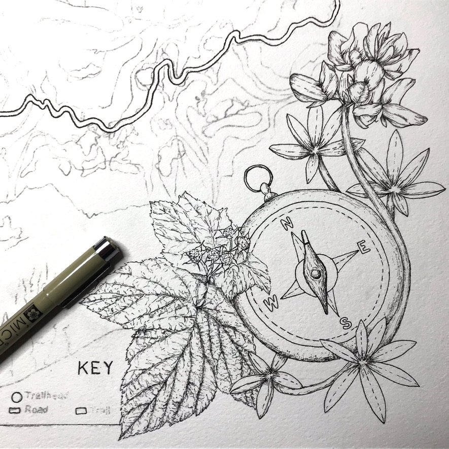
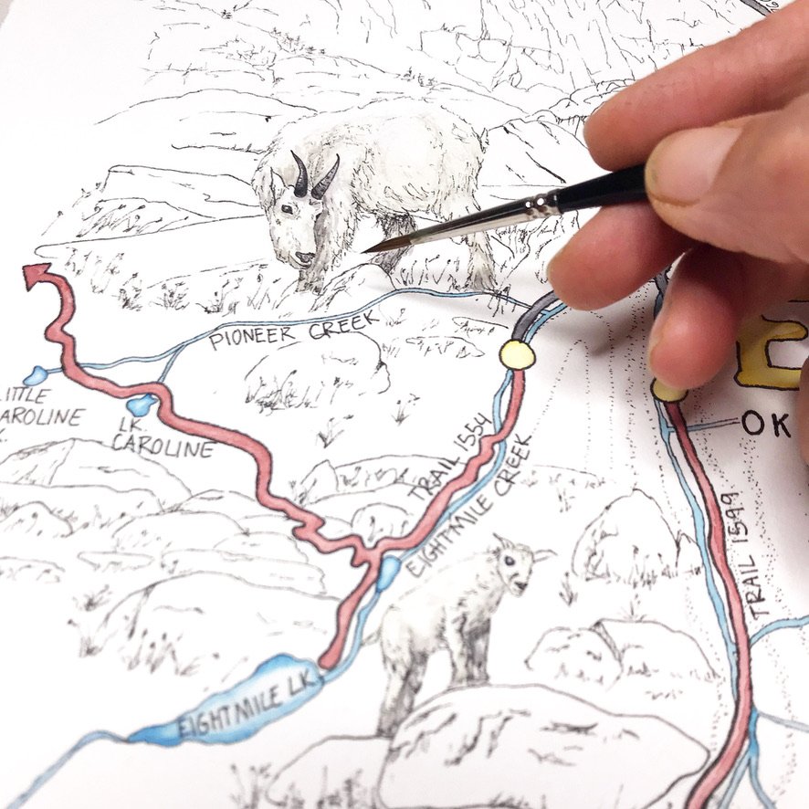
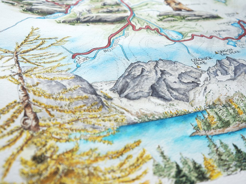
The first map I created is for the wondrous Enchantments. This area is located outside of Leavenworth, Washington. It’s an idealistic area peppered with crystal blue lakes, granite peaks, and mountain goats wandering throughout. The beauty of the area is magnificent and keeps me coming back for backpacking and day hiking trips. The hiking map features: Prusik Peak, mountain goats, golden larch trees, Colchuck Lake, Dragontail Peak, a marmot, thimble berries, and lupine.
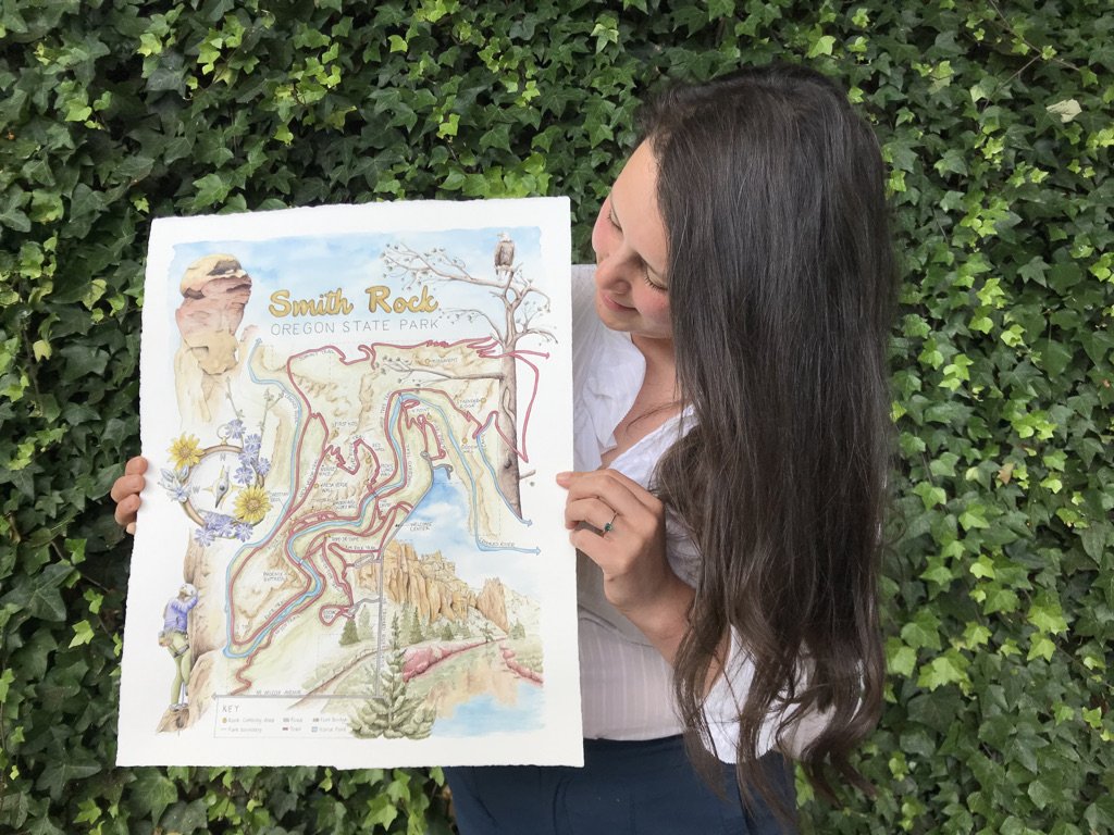
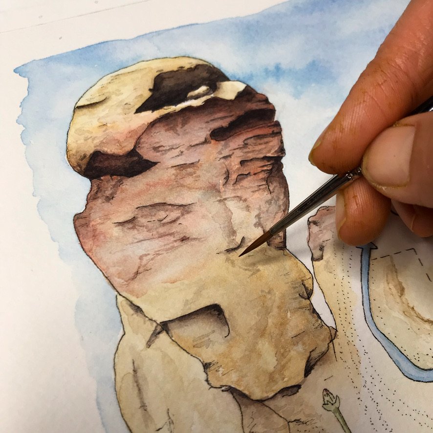
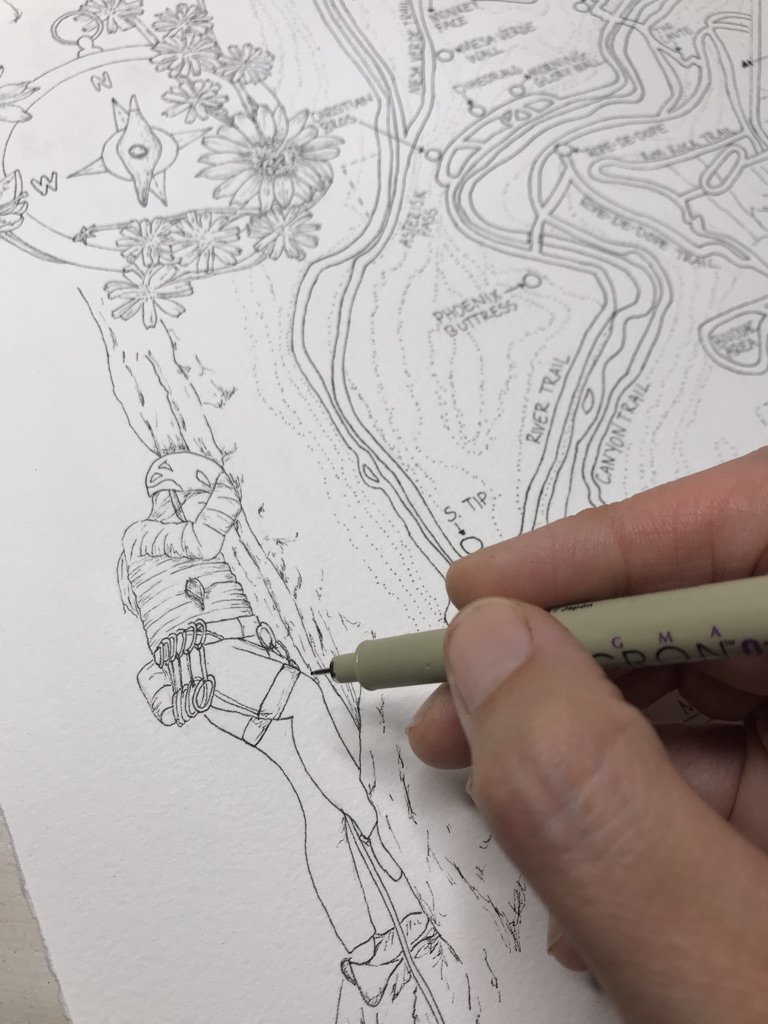
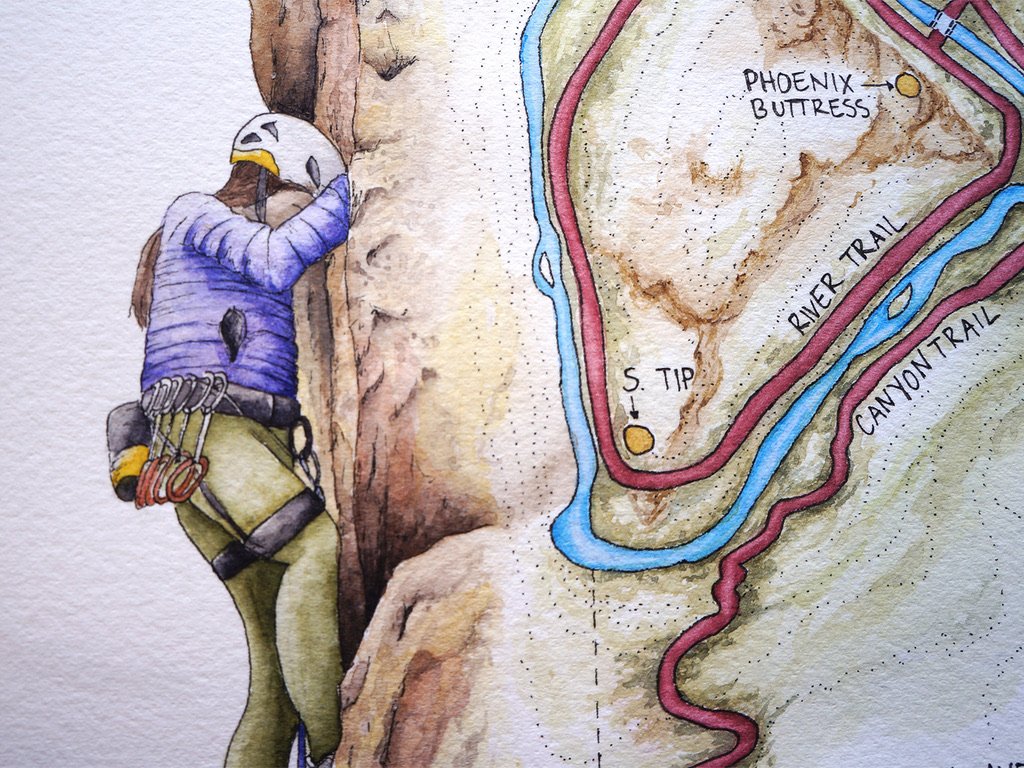
The second map I created was for Smith Rock State Park. This park beckons one to Oregon's high desert. Its scenic views of deep river canyons and sheer cliffs of tuff and basalt make it a destination for adventurers of all kinds: climbers, hikers, bikers, equestrians, and nature lovers. This hiking and climbing map features: a Bald Eagle on a Ponderosa Pine Tree, Monkey Face, a rock climber, a scene of the Crooked River and Picnic Lunch Wall, Chicory, Arrowleaf Balsamroot, and White-Stemmed Frasera.